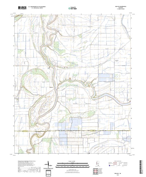
2024 Map of Kinlock
USGS Topo · Published 2024About this map
The Big Sunflower River meanders through this agricultural landscape at the junction of Sunflower, Washington, and Humphreys counties. The small settlement of Kinlock sits near a prominent bend in the river, surrounded by a network of drainage bayous and brakes that define the alluvial character of the Delta. To the north, Hickory Bluff Cem marks a point of local genealogical interest, while the presence of Lang Flying Service underscores the importance of aerial application in this region's farming economy.
Find a feature on this map
59 named features on this map. Tap any name to fly to it.
Don’t see what you’re looking for? This feature index may not catch every label — zoom into the map to look around manually.
Map Details
Editions of this 2024 Kinlock Map
This is the sole edition of this map. No revisions or reprints were ever made.
Other maps of this area

1939 · Tralake
USGS Topo · 1:62,500

1939 · Swan Lake
USGS Topo · 1:62,500

1940 · Auter
USGS Topo · 1:62,500

1940 · Baird
USGS Topo · 1:62,500

1953 · Greenwood
USGS Topo · 1:250,000

1956 · Greenwood
USGS Topo · 1:250,000

1965 · Inverness
USGS Topo · 1:24,000

1965 · Indianola
USGS Topo · 1:24,000

1965 · Kinlock
USGS Topo · 1:24,000
1965 · Bellewood
USGS Topo · 1:24,000