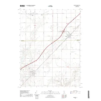
2018 Map of Kinmundy
USGS Topo · Published 2018About this map
Kinmundy and Farina anchor this south-central Illinois landscape, where the prairie transitions across the Fayette Co Marion Co line. The terrain is defined by a dense network of creek drainages, including the N Fork E Fork Kaskaskia River and Schneider Springs Br, which carve subtle valleys through the agricultural grid. These waterways have long dictated the placement of early settlements and rural infrastructure.
Find a feature on this map
92 named features on this map. Tap any name to fly to it.
Don’t see what you’re looking for? This feature index may not catch every label — zoom into the map to look around manually.
Map Details
Editions of this 2018 Kinmundy Map
This is the sole edition of this map. No revisions or reprints were ever made.
Other maps of this area

1934 · Salem
USGS Topo · 1:62,500

1938 · Salem
USGS Topo · 1:62,500

1945 · Kinmundy
USGS Topo · 1:62,500

1947 · Kinmundy
USGS Topo · 1:62,500

1952 · Xenia
USGS Topo · 1:62,500

1956 · Edgewood
USGS Topo · 1:62,500

1958 · Belleville
USGS Topo · 1:250,000

1962 · Belleville
USGS Topo · 1:250,000
1965 · Salem North
USGS Topo · 1:24,000
1965 · Omega
USGS Topo · 1:24,000