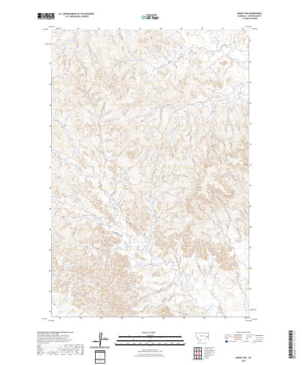
2024 Map of Kinsey NW
USGS Topo · Published 2024About this map
The drainage systems of eastern Custer County define this portion of the Montana badlands, where deep dissection of the plateau creates a complex network of dry washes and seasonal streams. The northern reaches are dominated by Custer Creek, while the southern terrain is carved by the intermittent flows of Harris Creek and Saugus Creek. This 2024 survey captures the intricate topographic contours of a landscape primarily utilized for large-scale ranching and open-range grazing. The absence of permanent settlements or structures underscores the isolation of this corner of the state. Prominent landforms such as Caprock Coulee and Cabin Creek illustrate the erosional forces that continue to shape the regional geology within the Public Land Survey System grids of T11N and T12N.
Find a feature on this map
11 named features on this map. Tap any name to fly to it.
Don’t see what you’re looking for? This feature index may not catch every label — zoom into the map to look around manually.
Map Details
Editions of this 2024 Kinsey NW Map
This is the sole edition of this map. No revisions or reprints were ever made.
Other maps of this area

1953 · Miles City
USGS Topo · 1:250,000

1957 · Miles City
USGS Topo · 1:250,000

1958 · Miles City
USGS Topo · 1:250,000

1965 · Morehouse Creek
USGS Topo · 1:24,000

1969 · Noble Reservoir
USGS Topo · 1:24,000

1969 · Kinsey NE
USGS Topo · 1:24,000
1969 · Coal Bank Spring
USGS Topo · 1:24,000

1969 · Kinsey
USGS Topo · 1:24,000
1969 · Shirley
USGS Topo · 1:24,000
1969 · Kinsey NW
USGS Topo · 1:24,000