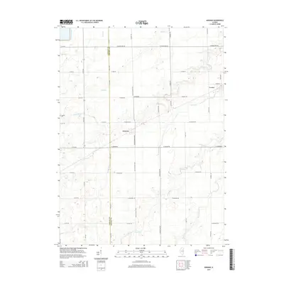
2015 Map of Kinsman
USGS Topo · Published 2015About this map
The boundary between LaSalle and Grundy Counties bisects this agricultural landscape, where the settlements of Kinsman and Verona anchor a vast grid of section roads. The terrain is defined by a dense network of prairie waterways, including the winding Waupecan Creek and Johnny Run, which drain the surrounding fields. These drainage patterns influenced the placement of early road networks like W Grand Ridge Rd and S Kinsman Rd.
Find a feature on this map
39 named features on this map. Tap any name to fly to it.
Don’t see what you’re looking for? This feature index may not catch every label — zoom into the map to look around manually.
Map Details
Editions of this 2015 Kinsman Map
This is the sole edition of this map. No revisions or reprints were ever made.
Other maps of this area

1892 · Morris
USGS Topo · 1:62,500

1892 · Marseilles
USGS Topo · 1:62,500

1916 · Marseilles
USGS Topo · 1:62,500

1918 · Morris
USGS Topo · 1:62,500

1940 · Marseilles
USGS Topo · 1:62,500

1948 · Dwight
USGS Topo · 1:62,500

1950 · Dwight
USGS Topo · 1:62,500

1953 · Morris
USGS Topo · 1:24,000
1954 · Morris
USGS Topo · 1:62,500

1958 · Odell
USGS Topo · 1:62,500