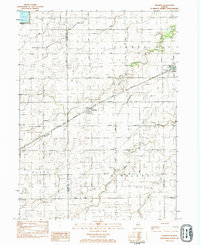
1983 Map of Kinsman
USGS Topo · Published 1983About this map
Kinsman and Verona anchor this rural landscape in the early 1980s, situated at the intersection of several townships including Brookfield, Vienna, Allen, and Highland. The Atchison Topeka and Santa Fe railroad cuts diagonally across the center of the sheet, providing a primary transportation axis through the prairie farmland. Local landmarks include Highland Cem in the southeast and a Mine located north of Prairie Road, indicating the diverse agricultural and industrial uses of the land.
Find a feature on this map
24 named features on this map. Tap any name to fly to it.
Don’t see what you’re looking for? This feature index may not catch every label — zoom into the map to look around manually.
Map Details
Editions of this 1983 Kinsman Map
This is the sole edition of this map. No revisions or reprints were ever made.
Other maps of this area

1892 · Morris
USGS Topo · 1:62,500

1892 · Marseilles
USGS Topo · 1:62,500

1916 · Marseilles
USGS Topo · 1:62,500

1918 · Morris
USGS Topo · 1:62,500

1940 · Marseilles
USGS Topo · 1:62,500

1948 · Dwight
USGS Topo · 1:62,500

1950 · Dwight
USGS Topo · 1:62,500

1953 · Morris
USGS Topo · 1:24,000
1954 · Morris
USGS Topo · 1:62,500

1958 · Odell
USGS Topo · 1:62,500