
1916 Map of Kinston
USGS Topo · Published 1916About this map
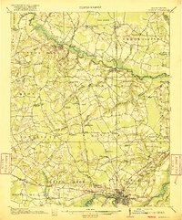
Snow Hill and Kinston anchor this 1916 survey of eastern North Carolina, where the winding Contentnea Creek and the Neuse River define the local geography. The landscape is a detailed record of rural social infrastructure, densely packed with family-named schools and churches like Suggs School, Jericho School, and Wheat Swamp Church. The presence of the State School for Feeble Minded west of Kinston provides a specific marker of early 20th-century institutional history in Lenoir County.
Find a feature on this map
81 named features on this map. Tap any name to fly to it.
Don’t see what you’re looking for? This feature index may not catch every label — zoom into the map to look around manually.
Map Details
Editions of this 1916 Kinston Map
3 editions found
Other maps of this area

1902 · Ayden
USGS Topo · 1:62,500

1903 · Winterville
USGS Topo · 1:62,500

1903 · Trent River
USGS Topo · 1:62,500

1904 · Ayden
USGS Topo · 1:62,500

1904 · Trent River
USGS Topo · 1:62,500

1904 · Falkland
USGS Topo · 1:62,500

1904 · Wilson
USGS Topo · 1:62,500

1905 · Winterville
USGS Topo · 1:62,500

1914 · Kinston
USGS Topo · 1:48,000

1953 · Rocky Mount
USGS Topo · 1:250,000