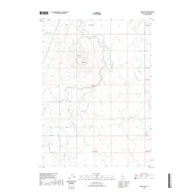
2020 Map of Kinzie Butte
USGS Topo · Published 2020About this map
Kinzie Butte rises as a prominent landmark in this Lincoln County landscape, centered within a sophisticated network of high-desert water management. The area is defined by its reliance on the Big Wood River, which winds through the center of the sheet, feeding an extensive system of irrigation infrastructure. This network includes the Lincoln Canal, Lincoln Bypass Canal, and the North Shoshone Canal, alongside numerous numbered laterals like Lateral 204 and Lateral 175. This complex grid of man-made waterways illustrates the region's agricultural transformation and its careful regulation of seasonal water flow.
Find a feature on this map
39 named features on this map. Tap any name to fly to it.
Don’t see what you’re looking for? This feature index may not catch every label — zoom into the map to look around manually.
Map Details
Editions of this 2020 Kinzie Butte Map
This is the sole edition of this map. No revisions or reprints were ever made.
Other maps of this area

1955 · Twin Falls
USGS Topo · 1:250,000

1955 · Hailey
USGS Topo · 1:250,000

1958 · Twin Falls
USGS Topo · 1:250,000

1959 · Hailey
USGS Topo · 1:250,000

1962 · Hailey
USGS Topo · 1:250,000

1971 · Dietrich
USGS Topo · 1:24,000

1971 · Dietrich Butte
USGS Topo · 1:24,000
1971 · Shoshone
USGS Topo · 1:24,000
1979 · Richfield
USGS Topo · 1:24,000

1979 · Shoshone Ice Cave
USGS Topo · 1:24,000