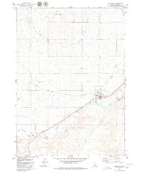
1979 Map of Richfield
USGS Topo · Published 1979About this map
The town of Richfield serves as the central hub of this South-Central Idaho landscape, where the Union Pacific railroad cuts a diagonal line across the high desert terrain. The area's agricultural life is defined by a complex network of irrigation, including the Main Canal and East Canal, which draw from the Little Wood River to transform the arid ground near Johnson Butte. To the southwest, the small settlement of Marley sits near the rail line, while Reynolds Airport and a local Cem provide evidence of the community's established infrastructure. The presence of Lava fields and numerous sloughs like Jim Byrns Slough illustrate the unique volcanic and hydrological character of the Snake River Plain, where early 20th-century water management projects were essential for ranching and farming stability.
Find a feature on this map
16 named features on this map. Tap any name to fly to it.
Don’t see what you’re looking for? This feature index may not catch every label — zoom into the map to look around manually.
Map Details
Editions of this 1979 Richfield Map
This is the sole edition of this map. No revisions or reprints were ever made.
Other maps of this area

1955 · Twin Falls
USGS Topo · 1:250,000

1955 · Hailey
USGS Topo · 1:250,000

1958 · Twin Falls
USGS Topo · 1:250,000

1959 · Hailey
USGS Topo · 1:250,000

1962 · Hailey
USGS Topo · 1:250,000

1971 · Owinza
USGS Topo · 1:24,000

1971 · Dietrich
USGS Topo · 1:24,000

1971 · Dietrich Butte
USGS Topo · 1:24,000

1979 · Shoshone Ice Cave
USGS Topo · 1:24,000
1979 · Tapper Lake
USGS Topo · 1:24,000