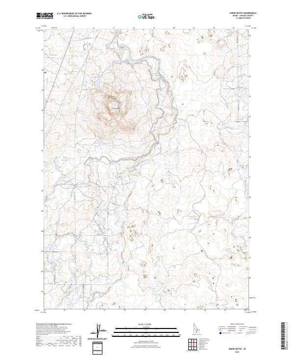
2024 Map of Kinzie Butte
USGS Topo · Published 2024About this map
Kinzie Butte rises as a prominent landmark in this Lincoln County landscape, surrounded by an intricate network of irrigation infrastructure essential to Idaho agriculture. The passage of the Big Wood River through the center of the quadrangle is augmented by the Lincoln Bypass Canal and the North-Shoshone Canal, illustrating the engineered transformation of this high desert environment. Small-scale water management is evident through numerous specialized catchments such as Little Cottonwood Reservoir, Kinzie Butte Reservoir, and the appropriately named Test Reservoir. The local transportation grid, including Old Hwy 93 and Burmah Rd, follows the section lines of the Public Land Survey System, providing access to a territory defined by its lateral canals and winding waterways like Cottonwood Slough.
Find a feature on this map
32 named features on this map. Tap any name to fly to it.
Don’t see what you’re looking for? This feature index may not catch every label — zoom into the map to look around manually.
Map Details
Editions of this 2024 Kinzie Butte Map
This is the sole edition of this map. No revisions or reprints were ever made.
Other maps of this area

1955 · Twin Falls
USGS Topo · 1:250,000

1955 · Hailey
USGS Topo · 1:250,000

1958 · Twin Falls
USGS Topo · 1:250,000

1959 · Hailey
USGS Topo · 1:250,000

1962 · Hailey
USGS Topo · 1:250,000

1971 · Dietrich
USGS Topo · 1:24,000

1971 · Dietrich Butte
USGS Topo · 1:24,000
1971 · Shoshone
USGS Topo · 1:24,000
1979 · Richfield
USGS Topo · 1:24,000

1979 · Shoshone Ice Cave
USGS Topo · 1:24,000