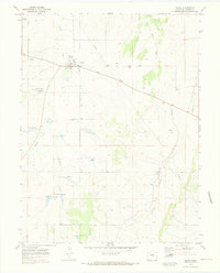
1970 Map of Kiowa
USGS Topo · Published 1973About this map
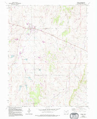
Kiowa serves as the focal point of this Elbert County landscape, situated at the junction of several drainage systems. The town layout is clearly defined, featuring the County Fairground and essential local infrastructure such as a WT and Radio Tower. The terrain is characterized by a series of north-flowing waterways, including Kiowa Creek, Wolf Creek, and Comanche Creek, which carve distinct paths through the high plains. A significant industrial presence is marked by a long Pipeline cutting diagonally across the eastern sections of the quadrangle. Smaller tributaries like Gopher Creek and scattered springs indicate the critical role of water management in this agricultural region, where fine red dashed lines on the map trace local fence lines across the open country.
Find a feature on this map
11 named features on this map. Tap any name to fly to it.
Don’t see what you’re looking for? This feature index may not catch every label — zoom into the map to look around manually.
Map Details
Editions of this 1970 Kiowa Map
5 editions found
Other maps of this area

1894 · Castle Rock
USGS Topo · 1:125,000

1913 · Castle Rock
USGS Topo · 1:125,000

1939 · Elizabeth
USGS Topo · 1:62,500

1940 · Elbert
USGS Topo · 1:62,500

1944 · Elbert
USGS Topo · 1:62,500

1945 · Elizabeth
USGS Topo · 1:62,500

1953 · Denver
USGS Topo · 1:250,000

1957 · Denver
USGS Topo · 1:250,000

1958 · Denver
USGS Topo · 1:250,000

1960 · Denver
USGS Topo · 1:250,000