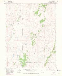
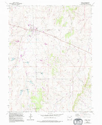
1970 Map of Kiowa
USGS Topo · Published 1979About this map
The town of Kiowa serves as the focal point of this 1970s landscape, situated at the confluence of several vital watercourses including Kiowa Creek and Wolf Creek. The map documents the local social and civic infrastructure of the era, notably the County Fairground and a centrally located Park within the town limits. Beyond the residential clusters, the terrain is defined by a network of drainage basins, including Comanche Creek and Gopher Creek, which shaped the agricultural and ranching patterns of this part of Elbert County. A prominent Pipeline and the Kiowa Radio Tower indicate the encroaching utility and communications infrastructure that characterized rural Colorado development during this period. Researchers will find a clear record of the town's footprint before later expansion, preserved at a time when these creek valleys remained the primary geographic dividers.
Find a feature on this map
13 named features on this map. Tap any name to fly to it.
Don’t see what you’re looking for? This feature index may not catch every label — zoom into the map to look around manually.
Map Details
Editions of this 1970 Kiowa Map
5 editions found
Other maps of this area

1894 · Castle Rock
USGS Topo · 1:125,000

1913 · Castle Rock
USGS Topo · 1:125,000

1939 · Elizabeth
USGS Topo · 1:62,500

1940 · Elbert
USGS Topo · 1:62,500

1944 · Elbert
USGS Topo · 1:62,500

1945 · Elizabeth
USGS Topo · 1:62,500

1953 · Denver
USGS Topo · 1:250,000

1957 · Denver
USGS Topo · 1:250,000

1958 · Denver
USGS Topo · 1:250,000

1960 · Denver
USGS Topo · 1:250,000