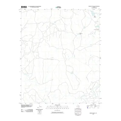
2010 Map of Kiowa Peak NE
USGS Topo · Published 2010About this map
The Brazos River winds through the southeastern corner of this King County landscape, which is defined by an intricate network of drainage basins and ranching infrastructure. Arid-land hydrology is prominent, as evidenced by the namesake Gyp Creek and the meandering course of North Croton Creek across the southern terrain. This region reflects a 21st-century balance between traditional livestock operations and energy extraction, centered around the Katz Oil Field and numerous earthen water impoundments. Private land management is visible in the naming of several artificial water bodies, including McElroy Lake and Arnold Ranch Lake, both supported by their respective dam structures. A sparse road network, consisting primarily of county routes like Co RD 379 and Co RD 385, provides the only access through this low-population ranching territory.
Find a feature on this map
16 named features on this map. Tap any name to fly to it.
Don’t see what you’re looking for? This feature index may not catch every label — zoom into the map to look around manually.
Map Details
Editions of this 2010 Kiowa Peak NE Map
This is the sole edition of this map. No revisions or reprints were ever made.
Other maps of this area

1954 · Lubbock
USGS Topo · 1:250,000

1954 · Wichita Falls
USGS Topo · 1:250,000

1958 · Wichita Falls
USGS Topo · 1:250,000

1962 · Kiowa Peak
USGS Topo · 1:24,000

1965 · Jud
USGS Topo · 1:24,000

1967 · Cedar Mountain
USGS Topo · 1:24,000

1967 · Dark Canyon
USGS Topo · 1:24,000

1967 · Knox City NW
USGS Topo · 1:24,000

1967 · Kiowa Peak NW
USGS Topo · 1:24,000

1967 · Kiowa Peak NE
USGS Topo · 1:24,000