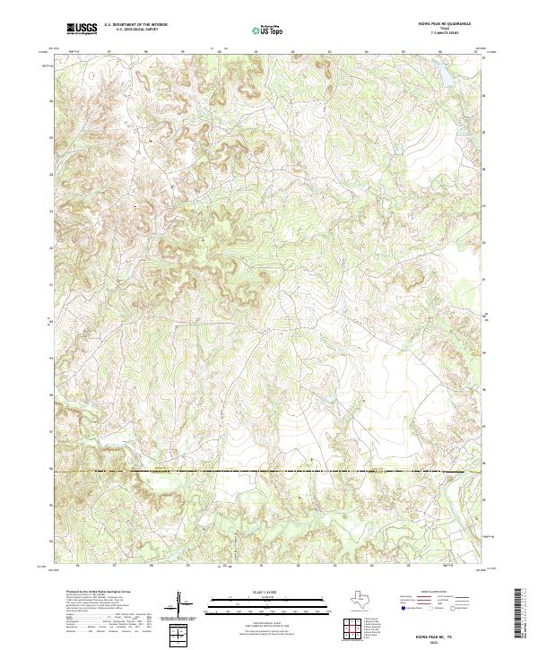
2022 Map of Kiowa Peak NE
USGS Topo · Published 2022About this map
The King Co and Stonewall Co border divides this West Texas landscape, where a network of ephemeral drainage systems and ranch roads defines the territory. The Brazos River cuts through the southeastern corner, while the deep relief of Smelter Canyon and the winding course of N Croton Cr illustrate the erosion patterns characteristic of the Rolling Plains. Local ranching operations are anchored by water features like Arnold Ranch Lake and crossings along Gyp Cr. A grid of county roads, including Co RD 352 and Co RD 379, provides access to the isolated high points and valleys of this sparsely populated cattle country. The map captures the specialized hydrology of the region, from the salt-influenced waters of N Croton Cr to the southern reach of Wedington Cr.
Find a feature on this map
13 named features on this map. Tap any name to fly to it.
Don’t see what you’re looking for? This feature index may not catch every label — zoom into the map to look around manually.
Map Details
Editions of this 2022 Kiowa Peak NE Map
This is the sole edition of this map. No revisions or reprints were ever made.
Other maps of this area

1954 · Lubbock
USGS Topo · 1:250,000

1954 · Wichita Falls
USGS Topo · 1:250,000

1958 · Wichita Falls
USGS Topo · 1:250,000

1962 · Kiowa Peak
USGS Topo · 1:24,000

1965 · Jud
USGS Topo · 1:24,000

1967 · Cedar Mountain
USGS Topo · 1:24,000

1967 · Dark Canyon
USGS Topo · 1:24,000

1967 · Knox City NW
USGS Topo · 1:24,000

1967 · Kiowa Peak NW
USGS Topo · 1:24,000

1967 · Kiowa Peak NE
USGS Topo · 1:24,000