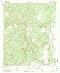
1962 Map of Kiowa Peak
USGS Topo · Published 1981About this map
Kiowa Peak dominates this landscape in northern Stonewall County, rising above a network of deeply eroded canyons and drainage systems. The terrain is characterized by the confluence of major West Texas waterways, most notably where the Double Mountain Fork meets the Salt Fork Brazos River. This confluence represents a significant hydrological landmark in the region's geography. Historically, the area shows signs of early industrial and resource development, evidenced by the Old Glory Oil Field and scattered infrastructure such as a Water Tank and several Drill Holes.
Find a feature on this map
18 named features on this map. Tap any name to fly to it.
Don’t see what you’re looking for? This feature index may not catch every label — zoom into the map to look around manually.
Map Details
Editions of this 1962 Kiowa Peak Map
2 editions found
Other maps of this area

1925 · Aspermont 4-a
USGS Topo · 1:48,000

1925 · Haskell 3-b
USGS Topo · 1:48,000

1931 · Aspermont
USGS Topo · 1:62,500

1954 · Lubbock
USGS Topo · 1:250,000

1954 · Wichita Falls
USGS Topo · 1:250,000

1958 · Wichita Falls
USGS Topo · 1:250,000

1962 · Kiowa Peak
USGS Topo · 1:24,000

1965 · Jud
USGS Topo · 1:24,000

1967 · Knox City NW
USGS Topo · 1:24,000

1967 · Kiowa Peak NW
USGS Topo · 1:24,000