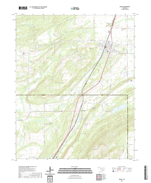
2022 Map of Kiowa
USGS Topo · Published 2022About this map
Kiowa serves as a central hub in this section of southeastern Oklahoma, where the established grid of the town meets the undulating terrain of Kiowa Hill. The landscape is defined by the transition from the flat agricultural lands north of 5 Mile Rd to the more varied elevations of Limestone Ridge and Pine Mtn in the south. This area, straddling the Pittsburg and Atoka County line, is heavily influenced by the drainage patterns of N Boggy Cr and its tributaries like Fivemile Cr. Local history is anchored by several burial sites, including Kiowa City Cem, Harpers Valley Cem, and Wards Cem, providing essential points of reference for genealogists. The presence of water bodies such as Country Club Lake and Kiowa Lake suggests a community oriented toward both regional transit and local recreational resources, while the small settlement of Reynolds sits quietly near the southern boundary.
Find a feature on this map
42 named features on this map. Tap any name to fly to it.
Don’t see what you’re looking for? This feature index may not catch every label — zoom into the map to look around manually.
Map Details
Editions of this 2022 Kiowa Map
This is the sole edition of this map. No revisions or reprints were ever made.
Other maps of this area

1896 · Coalgate
USGS Topo · 1:125,000

1898 · McAlester
USGS Topo · 1:125,000

1899 · Coalgate
USGS Topo · 1:125,000

1900 · Coalgate
USGS Topo · 1:125,000

1909 · Mc Alester
USGS Topo · 1:125,000

1950 · Mcalester
USGS Topo · 1:250,000

1957 · Coalgate SE
USGS Topo · 1:24,000

1957 · Limestone Gap
USGS Topo · 1:24,000

1957 · Ardmore
USGS Topo · 1:250,000

1962 · McAlester
USGS Topo · 1:250,000