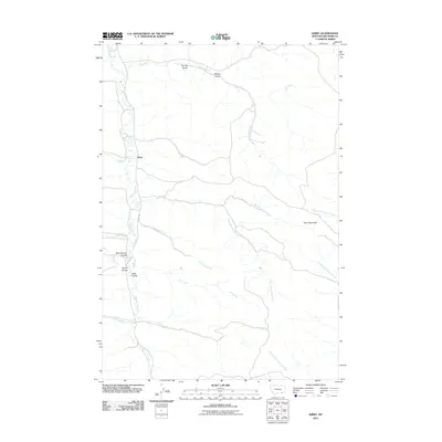
2011 Map of Kirby
USGS Topo · Published 2011About this map
The settlement of Kirby serves as the focal point for this section of Big Horn County, situated along the valley of Rosebud Creek. This 2011 survey by the U.S. Geological Survey illustrates a landscape defined by an intricate network of drainages and traditional land-naming conventions of the American West. Key watercourses such as Coal Bank Creek, Dale Creek, and Elk Creek carve through the terrain, flanked by notable geographical features like Horn Mountain and several coulees, including Schoolhouse Coulee and Smith Coulee. These names suggest a history of early educational sites and local landmarks recognized by ranching families in the Busby District. The proximity of Spring Gulch and Sheep Gulch further highlights the area's agricultural roots. The primary thoroughfare, Kirby Rd, follows the creek bed, connecting this rural community to the broader Montana landscape and providing a clear view of the region's topography before more modern developments.
Find a feature on this map
22 named features on this map. Tap any name to fly to it.
Don’t see what you’re looking for? This feature index may not catch every label — zoom into the map to look around manually.
Map Details
Editions of this 2011 Kirby Map
This is the sole edition of this map. No revisions or reprints were ever made.
Other maps of this area

1894 · Rosebud
USGS Topo · 1:125,000

1901 · Rosebud
USGS Topo · 1:125,000

1954 · Hardin
USGS Topo · 1:250,000

1957 · Hardin
USGS Topo · 1:250,000

1958 · Hardin
USGS Topo · 1:250,000

1958 · Bull Creek Lookout
USGS Topo · 1:24,000

1958 · Birdseye Spring
USGS Topo · 1:24,000

1967 · Tongue River Dam
USGS Topo · 1:24,000

1967 · Kirby
USGS Topo · 1:24,000

1967 · Bar V Ranch NE
USGS Topo · 1:24,000