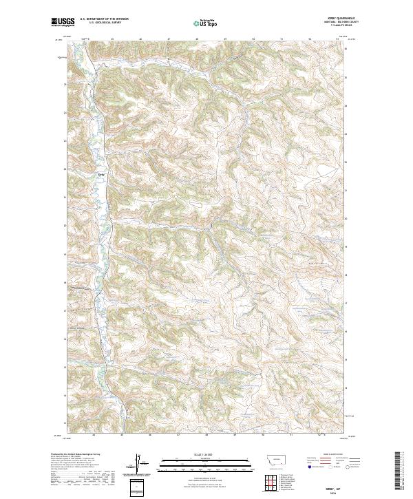
2024 Map of Kirby
USGS Topo · Published 2024About this map
Kirby occupies a high-elevation valley in Big Horn County, situated along the winding course of Rosebud Creek. This area of Montana is defined by its dramatic coulees and creek drainage systems, where water sources like Coal Bank Creek and Elk Creek have carved deep incisions into the landscape. The settlement is anchored by Co RD 314, which follows the north-south riparian corridor, while Spring Ck Rd provides access to the western reaches of the quadrangle. The eastern terrain rises toward the prominent landmark of Horn Mtn. This topographic layout illustrates a historical reliance on these narrow valley floors for transport and habitation. Named features such as Schoolhouse Coulee and Smith Coulee suggest the early local geography of the region's homesteading era, where small-scale ranching and rural education hubs were organized around the complex network of dry and perennial streams.
Find a feature on this map
28 named features on this map. Tap any name to fly to it.
Don’t see what you’re looking for? This feature index may not catch every label — zoom into the map to look around manually.
Map Details
Editions of this 2024 Kirby Map
This is the sole edition of this map. No revisions or reprints were ever made.
Other maps of this area

1894 · Rosebud
USGS Topo · 1:125,000

1901 · Rosebud
USGS Topo · 1:125,000

1954 · Hardin
USGS Topo · 1:250,000

1957 · Hardin
USGS Topo · 1:250,000

1958 · Hardin
USGS Topo · 1:250,000

1958 · Bull Creek Lookout
USGS Topo · 1:24,000

1958 · Birdseye Spring
USGS Topo · 1:24,000

1967 · Tongue River Dam
USGS Topo · 1:24,000

1967 · Kirby
USGS Topo · 1:24,000

1967 · Bar V Ranch NE
USGS Topo · 1:24,000