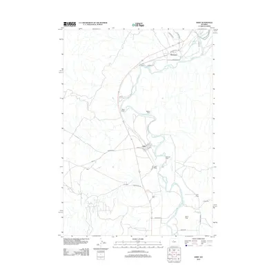
2012 Map of Kirby
USGS Topo · Published 2012About this map
The Bighorn River carves a path through this high-plains landscape, where the town of Kirby serves as a central hub for the surrounding ranching and industrial activity. Settled along the riverbanks, the community is defined by its grid of streets including W Main St and S Dickie St. This 2012 survey illustrates a landscape deeply shaped by extraction and water management, with the Kirby Ditch and Bluff Ditch providing critical irrigation to the arid basin.
Find a feature on this map
33 named features on this map. Tap any name to fly to it.
Don’t see what you’re looking for? This feature index may not catch every label — zoom into the map to look around manually.
Map Details
Editions of this 2012 Kirby Map
This is the sole edition of this map. No revisions or reprints were ever made.
Other maps of this area

1914 · Blue Mesa
USGS Topo · 1:62,500

1916 · Blue Mesa
USGS Topo · 1:62,500

1945 · Kirby
USGS Topo · 1:62,500

1946 · Kirby
USGS Topo · 1:62,500

1955 · Thermopolis
USGS Topo · 1:250,000

1958 · Thermopolis
USGS Topo · 1:250,000

1960 · Red Hole
USGS Topo · 1:24,000

1960 · Thermopolis
USGS Topo · 1:24,000

1962 · Thermopolis
USGS Topo · 1:250,000
1965 · Rattlesnake Gulch
USGS Topo · 1:24,000