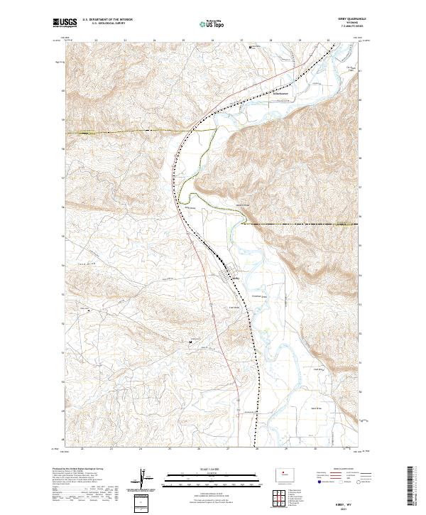
2021 Map of Kirby
USGS Topo · Published 2021About this map
Kirby and the surrounding high plains of Hot Springs County are defined by the intricate relationship between arid terrain and vital water management. The Bighorn River snakes through the landscape, flanked by engineered waterways like the Upper Hanover Canal, Bluff Ditch, and Kirby Ditch that support agricultural life in this dry Wyoming basin. The map reveals a legacy of resource extraction and local heritage through features like Gebo Oil Field Rd and the Cowboy Mine Rd, which branch out toward the rugged draws and flats.
Find a feature on this map
33 named features on this map. Tap any name to fly to it.
Don’t see what you’re looking for? This feature index may not catch every label — zoom into the map to look around manually.
Map Details
Editions of this 2021 Kirby Map
This is the sole edition of this map. No revisions or reprints were ever made.
Other maps of this area

1914 · Blue Mesa
USGS Topo · 1:62,500

1916 · Blue Mesa
USGS Topo · 1:62,500

1945 · Kirby
USGS Topo · 1:62,500

1946 · Kirby
USGS Topo · 1:62,500

1955 · Thermopolis
USGS Topo · 1:250,000

1958 · Thermopolis
USGS Topo · 1:250,000

1960 · Red Hole
USGS Topo · 1:24,000

1960 · Thermopolis
USGS Topo · 1:24,000

1962 · Thermopolis
USGS Topo · 1:250,000
1965 · Rattlesnake Gulch
USGS Topo · 1:24,000