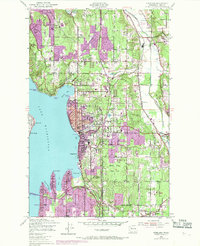
1950 Map of Kirkland
USGS Topo · Published 1969About this map
Lake Washington defines the western edge of this 1950 landscape, which documents a pivotal era of suburban expansion around Kirkland and Bellevue. While the interior remains largely wooded or agricultural, as evidenced by Bridle Trail State Park and the Sammamish River valley, the 1968 purple revisions reveal rapid residential growth pushing east from the shoreline. The map captures the infrastructure of the mid-century community, from the U S Naval Air Station at Sand Pt to established institutions like St Edwards Seminary and Northwest College. Transportation networks are in transition, featuring the Evergreen Point Bridge and the Northern Pacific railroad line through York and Willows. Smaller settlements such as Houghton, Juanita, and Redmond are shown before their eventual consolidation into the modern metropolitan landscape.
Find a feature on this map
54 named features on this map. Tap any name to fly to it.
Don’t see what you’re looking for? This feature index may not catch every label — zoom into the map to look around manually.
Map Details
Editions of this 1950 Kirkland Map
4 editions found

Other maps of this area

1894 · Seattle
USGS Topo · 1:62,500

1895 · Snohomish
USGS Topo · 1:125,000

1897 · Seattle
USGS Topo · 1:125,000

1908 · Seattle
USGS Topo · 1:62,500

1909 · Seattle Special
USGS Topo · 1:62,500

1942 · Edmonds
USGS Topo · 1:62,500

1944 · Everett
USGS Topo · 1:62,500

1949 · Seattle North
USGS Topo · 1:24,000
1949 · Seattle South
USGS Topo · 1:24,000

1950 · Redmond
USGS Topo · 1:24,000