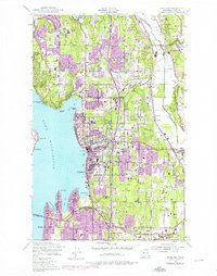
1950 Map of Kirkland
USGS Topo · Published 1976About this map
Lake Washington dominates the western edge of this landscape, framing the rapid expansion of the Eastside during the mid-20th century. The suburban transition is visible in the dense clusters around Kirkland and Bellevue, while institutional landmarks like St Edwards Seminary and Inglemoor High Sch anchor the residential growth. Major infrastructure such as the Evergreen Point Bridge and the Burlington Northern railroad corridor illustrate the vital transportation links connecting these shoreline communities.
Find a feature on this map
55 named features on this map. Tap any name to fly to it.
Don’t see what you’re looking for? This feature index may not catch every label — zoom into the map to look around manually.
Map Details
Editions of this 1950 Kirkland Map
4 editions found

Other maps of this area

1894 · Seattle
USGS Topo · 1:62,500

1895 · Snohomish
USGS Topo · 1:125,000

1897 · Seattle
USGS Topo · 1:125,000

1908 · Seattle
USGS Topo · 1:62,500

1909 · Seattle Special
USGS Topo · 1:62,500

1942 · Edmonds
USGS Topo · 1:62,500

1944 · Everett
USGS Topo · 1:62,500

1949 · Seattle North
USGS Topo · 1:24,000
1949 · Seattle South
USGS Topo · 1:24,000

1950 · Redmond
USGS Topo · 1:24,000