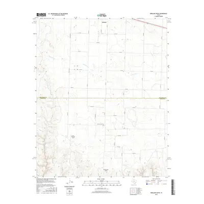
2016 Map of Kirkland South
USGS Topo · Published 2016About this map
Tennessee Valley Cem sits near the heart of this landscape, marking a site of local heritage within the sparsely populated ranchlands of North Texas. The terrain is defined by the winding course of S Groesbeck Cr and the deeply incised Ninety-Foot Canyon to the south, illustrating the erosive power of seasonal water in this arid environment. Transportation across this rural expanse relies on a network of farm-to-market and county roads, including FM 1033 and FM 104, which connect isolated homesteads and the settlement of Kirkland. The presence of the Buckle L Ranch East Airport underscores the vast distances inherent to the region's ranching operations. Crossing the boundary between Childress and Cottle counties, the map reveals a rugged geography where drainage systems like Raggedy Bill Cr carve through the plains.
Find a feature on this map
36 named features on this map. Tap any name to fly to it.
Don’t see what you’re looking for? This feature index may not catch every label — zoom into the map to look around manually.
Map Details
Editions of this 2016 Kirkland South Map
This is the sole edition of this map. No revisions or reprints were ever made.
Other maps of this area

1927 · Quanah 3-b
USGS Topo · 1:48,000

1932 · Vivian
USGS Topo · 1:62,500

1954 · Plainview
USGS Topo · 1:250,000

1955 · Lawton
USGS Topo · 1:250,000

1958 · Plainview
USGS Topo · 1:250,000

1960 · Goodlett
USGS Topo · 1:62,500

1960 · Teacup Mountain
USGS Topo · 1:62,500

1967 · Buckle L Ranch
USGS Topo · 1:24,000

1967 · Kirkland South
USGS Topo · 1:24,000

1967 · Kirkland North
USGS Topo · 1:24,000