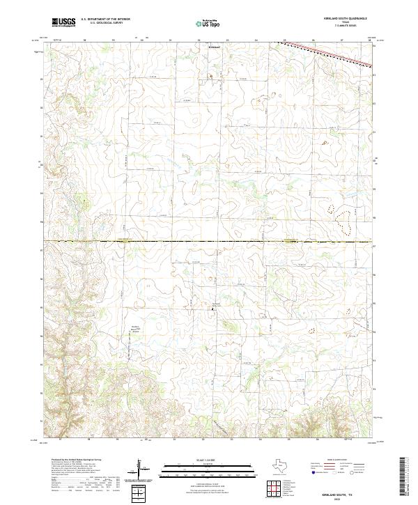
2022 Map of Kirkland South
USGS Topo · Published 2022About this map
The border between Childress Co and Cottle Co bisects this West Texas landscape, dominated by the rolling drainage systems of S Groesbeck Cr and Raggedy Bill Cr. In the northern portion, the settlement of Kirkland sits near the upper margin, while the southern reach is defined by the sharp incision of Ninety-Foot Canyon. This map records the modern layout of rural ranch roads and state highways like Fm 1033 that crisscross the expansive grazing lands. Genealogy and local history researchers will find the location of the Tennessee Valley Cem and the Buckle L Ranch East Airport, reflecting the ranching heritage and aviation infrastructure of the Rolling Plains. The intricate contour lines detail the erosion patterns typical of the region's breaks, showing how the land falls away into the named draws and canyons.
Find a feature on this map
35 named features on this map. Tap any name to fly to it.
Don’t see what you’re looking for? This feature index may not catch every label — zoom into the map to look around manually.
Map Details
Editions of this 2022 Kirkland South Map
This is the sole edition of this map. No revisions or reprints were ever made.
Other maps of this area

1927 · Quanah 3-b
USGS Topo · 1:48,000

1932 · Vivian
USGS Topo · 1:62,500

1954 · Plainview
USGS Topo · 1:250,000

1955 · Lawton
USGS Topo · 1:250,000

1958 · Plainview
USGS Topo · 1:250,000

1960 · Goodlett
USGS Topo · 1:62,500

1960 · Teacup Mountain
USGS Topo · 1:62,500

1967 · Buckle L Ranch
USGS Topo · 1:24,000

1967 · Kirkland South
USGS Topo · 1:24,000

1967 · Kirkland North
USGS Topo · 1:24,000