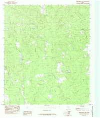
1984 Map of Kirkpatrick Lake
USGS Topo · Published 1985About this map
Kirkpatrick Lake and its surrounding wetlands anchor this 1978 field-checked landscape in East Texas, where the topography is defined by an intricate network of waterways. The terrain is deeply carved by the serpentine paths of Sevenmile Creek and Thouching Creek, which converge and drain toward the southern reaches of the quadrangle. This area reflects a quiet, rural character dominated by natural drainage patterns and small-scale water bodies like Spurlock Lake and Timber Lake.
Find a feature on this map
16 named features on this map. Tap any name to fly to it.
Don’t see what you’re looking for? This feature index may not catch every label — zoom into the map to look around manually.
Map Details
Editions of this 1984 Kirkpatrick Lake Map
This is the sole edition of this map. No revisions or reprints were ever made.
Other maps of this area

1954 · Beaumont
USGS Topo · 1:250,000

1955 · Woodville
USGS Topo · 1:62,500

1955 · Curtis
USGS Topo · 1:62,500

1957 · Beaumont
USGS Topo · 1:250,000

1958 · Warren
USGS Topo · 1:62,500

1958 · Spurger
USGS Topo · 1:62,500

1984 · Beaumont
USGS Topo · 1:250,000
1984 · Woodville
USGS Topo · 1:24,000
1984 · Town Bluff
USGS Topo · 1:24,000
1984 · Hillister
USGS Topo · 1:24,000