
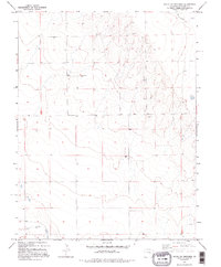
1982 Map of Kit Carson 4 NE
USGS Topo · Published 1982About this map
South Ladder Creek flows across the northern reaches of this High Plains landscape in Cheyenne County, where the topography is defined by the gradual drainages of the Colorado plateau. The 1982 data shows a remote region primarily organized by Section, Town, and Range boundaries, such as T 15 S T 16 S. Human activity is sparse but specific to the rural economy of the early 1980s, marked by scattered Well sites and isolated infrastructure like the Storage Bins in the northwest. To the south, the wide basin of Big Sandy Creek cuts through the terrain, while evidence of local industry appears at a Gravel Pit near the center of the sheet. This survey provides a precise view of the arid landscape before modern changes, documenting the exact placement of range improvements and water sources essential for plains ranching.
Find a feature on this map
8 named features on this map. Tap any name to fly to it.
Don’t see what you’re looking for? This feature index may not catch every label — zoom into the map to look around manually.
Map Details
Editions of this 1982 Kit Carson 4 NE Map
2 editions found
Other maps of this area

1891 · Kit Carson
USGS Topo · 1:125,000

1892 · Cheyenne Wells
USGS Topo · 1:125,000

1893 · Kit Carson
USGS Topo · 1:125,000

1894 · Cheyenne Wells
USGS Topo · 1:125,000

1954 · Lamar
USGS Topo · 1:250,000

1958 · Lamar
USGS Topo · 1:250,000

1981 · Cheyenne Wells
USGS Topo · 1:100,000
1982 · Kit Carson 4 SE
USGS Topo · 1:24,000

1982 · Cheyenne Wells SW
USGS Topo · 1:24,000

1982 · Kit Carson 4 NW
USGS Topo · 1:24,000