
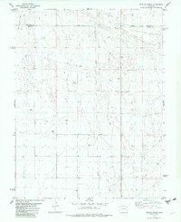
1982 Map of Kit Carson 4 NW
USGS Topo · Published 1982About this map
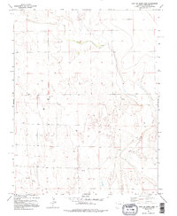
Big Sandy Creek and its tributary, Eureka Creek, define the drainage patterns of this high plains landscape in Cheyenne County. The topography is marked by a network of ephemeral streams and low-relief draws typical of the semi-arid Colorado eastern plains during the early 1980s. Agricultural and industrial activity is evidenced by several scattered Well sites and a Drill Hole, alongside a concentration of Storage Bins in the northeast quadrant. These features, combined with a buried Pipeline cutting across the southwestern corner, reflect a working landscape defined by resource extraction and dryland farming. The map provides a clear look at the township and range grid, specifically tracing the boundary between Townships 15 and 16 South and Ranges 47 and 48 West, illustrating how section lines dictated the placement of rural roads and land tracts.
Find a feature on this map
8 named features on this map. Tap any name to fly to it.
Don’t see what you’re looking for? This feature index may not catch every label — zoom into the map to look around manually.
Map Details
Editions of this 1982 Kit Carson 4 NW Map
2 editions found
Other maps of this area

1891 · Kit Carson
USGS Topo · 1:125,000

1893 · Kit Carson
USGS Topo · 1:125,000

1954 · Lamar
USGS Topo · 1:250,000

1958 · Lamar
USGS Topo · 1:250,000

1981 · Cheyenne Wells
USGS Topo · 1:100,000
1982 · Kit Carson 4 SE
USGS Topo · 1:24,000
1982 · Kit Carson
USGS Topo · 1:24,000

1982 · Kit Carson 4 NE
USGS Topo · 1:24,000
1982 · Firstview
USGS Topo · 1:24,000
1982 · Dunlap Ranch
USGS Topo · 1:24,000