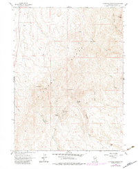
1962 Map of Kittridge Springs
USGS Topo · Published 1983About this map
The Adobe Range dominates this portion of Elko County, Nevada, where rugged peaks and ephemeral drainage systems define the high-desert terrain. Topography from 1958 and 1962 aerial surveys, with 1980s updates, reveals a landscape of ranching and early telecommunications infrastructure. The Kittridge Ranch and namesake Kittridge Springs represent the vital water-access points necessary for survival in this arid basin. High points like Sherman Peak and the East Twin formation watch over a network of seasonal watercourses, including Sixteenmile Creek and Eightmile Creek. A noteworthy sign of mid-century technical expansion is the Bell Radio Facility, positioned on a high ridge to provide line-of-sight communication across the range. The map also traces numerous four-wheel-drive trails that provide access to points like Knoby and Cherry Spring, illustrating the persistent remoteness of the region even into the latter half of the 20th century.
Find a feature on this map
20 named features on this map. Tap any name to fly to it.
Don’t see what you’re looking for? This feature index may not catch every label — zoom into the map to look around manually.
Map Details
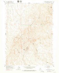
Editions of this 1962 Kittridge Springs Map

Other maps of this area

1955 · Wells
USGS Topo · 1:250,000

1955 · Elko
USGS Topo · 1:250,000

1957 · Elko West
USGS Topo · 1:24,000

1957 · Elko East
USGS Topo · 1:24,000

1958 · Wells
USGS Topo · 1:250,000

1958 · Elko
USGS Topo · 1:250,000

1958 · Singletree Creek
USGS Topo · 1:24,000

1958 · Hunter
USGS Topo · 1:24,000

1958 · Doby Summit
USGS Topo · 1:24,000

1961 · Wells
USGS Topo · 1:250,000