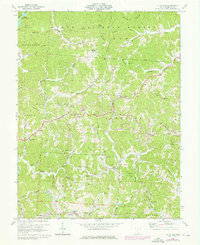
1972 Map of Kitts Hill
USGS Topo · Published 1976About this map
Wayne National Forest covers much of this landscape in southern Ohio, where steep ridges and deep hollows define the local settlement patterns. This 1972 survey captures the community of Kitts Hill and nearby Andis as they were connected by winding roads through the Elizabeth, Aid, and Upper townships. The map documents a rural environment with numerous family-named cemeteries such as Bald Knob Cem and Fields Cem, alongside local institutions like Rock Hill Sch.
Find a feature on this map
78 named features on this map. Tap any name to fly to it.
Don’t see what you’re looking for? This feature index may not catch every label — zoom into the map to look around manually.
Map Details
Editions of this 1972 Kitts Hill Map
Other maps of this area

1892 · Huntington
USGS Topo · 1:125,000

1898 · Huntington
USGS Topo · 1:125,000

1898 · Ironton
USGS Topo · 1:62,500

1900 · Ironton
USGS Topo · 1:62,500

1901 · Guyandot
USGS Topo · 1:62,500

1901 · Ceredo
USGS Topo · 1:62,500

1902 · Guyandot
USGS Topo · 1:62,500

1903 · Kenova
USGS Topo · 1:125,000

1904 · Kenova
USGS Topo · 1:125,000

1906 · Athalia
USGS Topo · 1:62,500