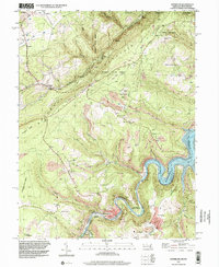
1997 Map of Kitzmiller
USGS Topo · Published 2001About this map
Kitzmiller and the surrounding coal-country settlements along the Potomac River define this 1997 topographic survey. The landscape is a complex intersection of industry and topography, where the B & O RR winds through the river valley, connecting towns like Blaine, Shallmar, and Chaffee. Numerous mining operations are evident across the terrain, including the Walnut Bottom Cr Strip Mine and the Hitchcock Tunnel.
Find a feature on this map
53 named features on this map. Tap any name to fly to it.
Don’t see what you’re looking for? This feature index may not catch every label — zoom into the map to look around manually.
Map Details
Editions of this 1997 Kitzmiller Map
This is the sole edition of this map. No revisions or reprints were ever made.
Other maps of this area

1895 · Piedmont
USGS Topo · 1:125,000

1899 · Grantsville
USGS Topo · 1:62,500

1899 · Oakland
USGS Topo · 1:62,500

1900 · Accident
USGS Topo · 1:62,500

1900 · Oakland
USGS Topo · 1:62,500

1904 · Grantsville
USGS Topo · 1:62,500

1919 · Elk Garden
USGS Topo · 1:48,000

1920 · Elk Garden
USGS Topo · 1:48,000

1922 · Elk Garden
USGS Topo · 1:62,500
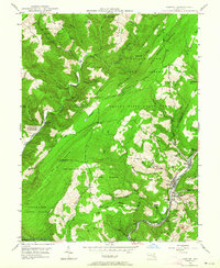
1947 · Barton
USGS Topo · 1:24,000