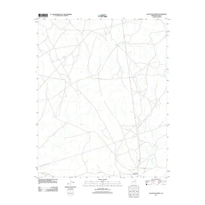
2011 Map of Klagetoh North
USGS Topo · Published 2011About this map
Klagetoh anchors the southern edge of this high-desert landscape within the Fort Defiance Agency, captured during a 2011 United States Geological Survey. The terrain is defined by the winding course of Wide Ruin Wash, which carves through the region alongside vital water sources such as Sagewood Spring and Sand Spring. These springs and washes have long dictated the movement and settlement patterns of the local community, as seen in the network of unpaved routes like Antelope Trl and Todikozh Rd. Utility and transportation infrastructure is prominent, with the Transwestern Pipeline Corp corridor and Pipe Line Rd cutting across the geography. The map provides a clear view of the modern road network, including Indian Rte-28 and Indian Rte-281, illustrating how contemporary access routes follow the natural topography of the Arizona plateau.
Find a feature on this map
11 named features on this map. Tap any name to fly to it.
Don’t see what you’re looking for? This feature index may not catch every label — zoom into the map to look around manually.
Map Details
Editions of this 2011 Klagetoh North Map
This is the sole edition of this map. No revisions or reprints were ever made.
Other maps of this area

1886 · Fort Defiance
USGS Topo · 1:250,000

1892 · Fort Defiance
USGS Topo · 1:250,000

1954 · Gallup
USGS Topo · 1:250,000

1955 · Zith-Tusayan Butte 3 NW
USGS Topo · 1:24,000

1958 · Gallup
USGS Topo · 1:250,000

1959 · Gallup
USGS Topo · 1:250,000

1962 · Gallup
USGS Topo · 1:250,000

1967 · Gallup
USGS Topo · 1:250,000

1971 · Wide Ruins
USGS Topo · 1:24,000
1971 · Tudecoz Spring
USGS Topo · 1:24,000