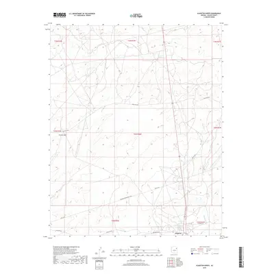
2018 Map of Klagetoh North
USGS Topo · Published 2018About this map
Klagetoh serves as the primary focal point in this high-desert landscape of the Navajo Nation during the late 2010s. The terrain is defined by a network of drainage systems including Big Dam Wash and the meandering path of Wide Ruin Wash. Essential water sources like Sagewood Spring and Sand Spring are documented, highlighting the critical nature of these features in an arid environment. The map details a complex infrastructure of transit and energy corridors, notably the Transwestern Pipeline Co Rd and Pipe Line Rd, which cut across the surveyed townships. Local connectivity is maintained through a system of designated routes such as Indian Rte 28 and Greasewood Rd, providing a clear view of how modern transportation and utility needs interface with the traditional geography of the Fort Defiance Agency.
Find a feature on this map
23 named features on this map. Tap any name to fly to it.
Don’t see what you’re looking for? This feature index may not catch every label — zoom into the map to look around manually.
Map Details
Editions of this 2018 Klagetoh North Map
This is the sole edition of this map. No revisions or reprints were ever made.
Other maps of this area

1886 · Fort Defiance
USGS Topo · 1:250,000

1892 · Fort Defiance
USGS Topo · 1:250,000

1954 · Gallup
USGS Topo · 1:250,000

1955 · Zith-Tusayan Butte 3 NW
USGS Topo · 1:24,000

1958 · Gallup
USGS Topo · 1:250,000

1959 · Gallup
USGS Topo · 1:250,000

1962 · Gallup
USGS Topo · 1:250,000

1967 · Gallup
USGS Topo · 1:250,000

1971 · Wide Ruins
USGS Topo · 1:24,000
1971 · Tudecoz Spring
USGS Topo · 1:24,000