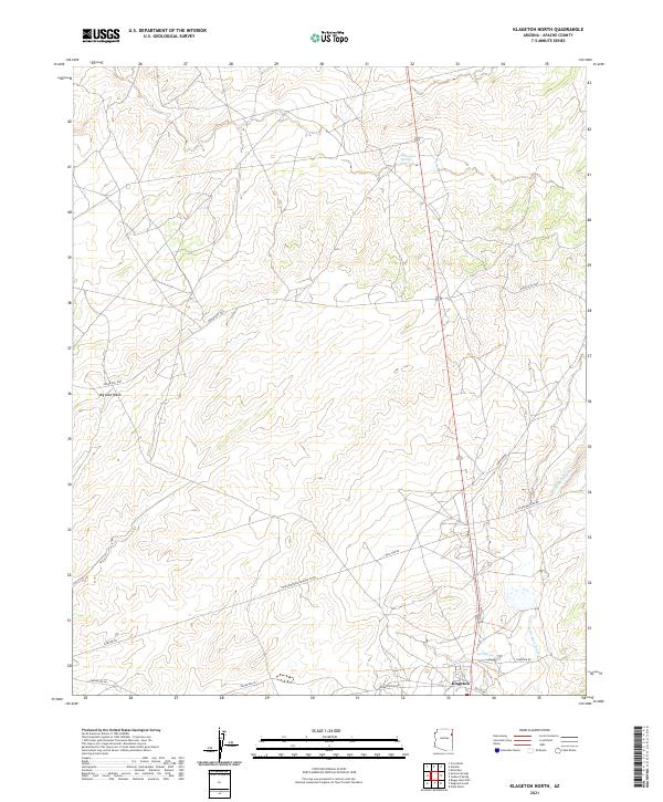
2021 Map of Klagetoh North
USGS Topo · Published 2021About this map
Klagetoh occupies the southern edge of this Arizona landscape, serving as a focal point for a network of local routes including Greasewood Rd and Valley Rd. The terrain is defined by its drainage patterns, most notably the seasonal flow of Big Dam Wash in the west and Wide Ruin Wash which snakes through the eastern half of the quadrangle. These natural watercourses are supplemented by vital water sources like Sand Spring and Sagewood Spring, which have long anchored activity in this part of Apache County.
Find a feature on this map
23 named features on this map. Tap any name to fly to it.
Don’t see what you’re looking for? This feature index may not catch every label — zoom into the map to look around manually.
Map Details
Editions of this 2021 Klagetoh North Map
This is the sole edition of this map. No revisions or reprints were ever made.
Other maps of this area

1886 · Fort Defiance
USGS Topo · 1:250,000

1892 · Fort Defiance
USGS Topo · 1:250,000

1954 · Gallup
USGS Topo · 1:250,000

1955 · Zith-Tusayan Butte 3 NW
USGS Topo · 1:24,000

1958 · Gallup
USGS Topo · 1:250,000

1959 · Gallup
USGS Topo · 1:250,000

1962 · Gallup
USGS Topo · 1:250,000

1967 · Gallup
USGS Topo · 1:250,000

1971 · Wide Ruins
USGS Topo · 1:24,000
1971 · Tudecoz Spring
USGS Topo · 1:24,000