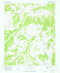
1973 Map of Klagetoh North
USGS Topo · Published 1976About this map
Klagetoh anchors the southeast corner of this high-desert landscape in the early 1970s, situated within the Navajo Indian Reservation. This map reveals a terrain defined by drainage patterns and critical water sources essential for life in this arid region, including Sagewood Spring and the Kaska Badoya Well. Cultural markers are sparse but significant, with a local Cem and Sand Spring located near the settlement. The infrastructure of the era is represented by a prominent Pipeline that traverses the northern and southern sections of the quadrangle, while Big Dam Wash and Wide Ruin Wash trace the natural topography of the land. The presence of a Borrow Pit suggests localized utility or road maintenance in this specific section of Apache County during the 1971 aerial survey.
Find a feature on this map
12 named features on this map. Tap any name to fly to it.
Don’t see what you’re looking for? This feature index may not catch every label — zoom into the map to look around manually.
Map Details
Editions of this 1973 Klagetoh North Map
This is the sole edition of this map. No revisions or reprints were ever made.
Other maps of this area

1886 · Fort Defiance
USGS Topo · 1:250,000

1892 · Fort Defiance
USGS Topo · 1:250,000

1954 · Gallup
USGS Topo · 1:250,000

1955 · Zith-Tusayan Butte 3 NW
USGS Topo · 1:24,000

1958 · Gallup
USGS Topo · 1:250,000

1959 · Gallup
USGS Topo · 1:250,000

1962 · Gallup
USGS Topo · 1:250,000

1967 · Gallup
USGS Topo · 1:250,000

1971 · Wide Ruins
USGS Topo · 1:24,000
1971 · Tudecoz Spring
USGS Topo · 1:24,000