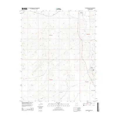
2014 Map of Klagetoh South
USGS Topo · Published 2014About this map
Klagetoh and Wide Ruins anchor this high-desert landscape in Apache County, where the topography is defined by an intricate network of drainages and seasonal watercourses. The major arterial Us-191 bisects the eastern half of the map, following a path roughly parallel to the winding Wide Ruin Wash. Smaller local routes like Valley Rd and Boggy Lake Rd branch into the interior, providing access to landmarks such as Pigeon Spring and the junction of Oak Ridge Wash. The terrain reveals a complex system of draws and washes, including Bent Knee Wash, which illustrate the natural drainage patterns of the Defiance Plateau region. This survey captures the transition between organized transport corridors and the more remote, trackless sections of the territory.
Find a feature on this map
22 named features on this map. Tap any name to fly to it.
Don’t see what you’re looking for? This feature index may not catch every label — zoom into the map to look around manually.
Map Details
Editions of this 2014 Klagetoh South Map
This is the sole edition of this map. No revisions or reprints were ever made.
Other maps of this area

1886 · Fort Defiance
USGS Topo · 1:250,000

1892 · Fort Defiance
USGS Topo · 1:250,000

1954 · Gallup
USGS Topo · 1:250,000

1958 · Gallup
USGS Topo · 1:250,000

1959 · Gallup
USGS Topo · 1:250,000

1962 · Gallup
USGS Topo · 1:250,000

1967 · Gallup
USGS Topo · 1:250,000

1971 · Wide Ruins
USGS Topo · 1:24,000
1971 · Tudecoz Spring
USGS Topo · 1:24,000
1971 · Wide Ruins SW
USGS Topo · 1:24,000