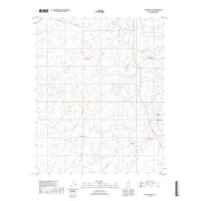
2018 Map of Klagetoh South
USGS Topo · Published 2018About this map
Wide Ruins stands as the primary focus of this high-desert landscape within Apache County, where the topography is defined by the branching drainage systems of Wide Ruin Wash and Oak Ridge Wash. The 2018 survey illustrates a complex network of local desert roads and trails that traverse the arid terrain, including Tanner Spring Rd and Klagetoh Loop. The presence of Pigeon Spring near the eastern margin of the map highlights the significance of water sources in this region. This modern topographic study reveals the sparse but intentional infrastructure of the area, connecting remote settlements through routes like Antelope Trl and Lower Greaswood Rd, which navigate the subtle changes in elevation across the township and range grids.
Find a feature on this map
15 named features on this map. Tap any name to fly to it.
Don’t see what you’re looking for? This feature index may not catch every label — zoom into the map to look around manually.
Map Details
Editions of this 2018 Klagetoh South Map
This is the sole edition of this map. No revisions or reprints were ever made.
Other maps of this area

1886 · Fort Defiance
USGS Topo · 1:250,000

1892 · Fort Defiance
USGS Topo · 1:250,000

1954 · Gallup
USGS Topo · 1:250,000

1958 · Gallup
USGS Topo · 1:250,000

1959 · Gallup
USGS Topo · 1:250,000

1962 · Gallup
USGS Topo · 1:250,000

1967 · Gallup
USGS Topo · 1:250,000

1971 · Wide Ruins
USGS Topo · 1:24,000
1971 · Tudecoz Spring
USGS Topo · 1:24,000
1971 · Wide Ruins SW
USGS Topo · 1:24,000