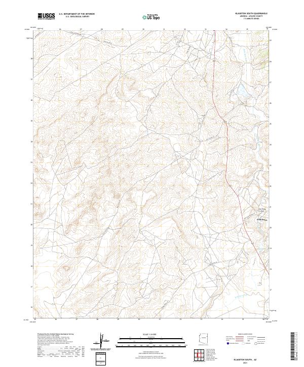
2021 Map of Klagetoh South
USGS Topo · Published 2021About this map
Wide Ruins serves as the primary focal point in this high-desert region of the Navajo Nation, where the convergence of Wide Ruin Wash and Oak Ridge Wash defines the drainage patterns of the plateau. The landscape is marked by a network of rural routes such as Klagetoh Loop and Tanner Spring Rd, reflecting a dispersed settlement pattern that relies on specific water points like Pigeon Spring. Modern infrastructure is represented by the alignment of Wide Ruins School Rd, connecting the community to local services. This survey captures the topographical nuances of the area's mesas and washes, providing a look at the geographic layout of southern Apache County in the early twenty-first century.
Find a feature on this map
17 named features on this map. Tap any name to fly to it.
Don’t see what you’re looking for? This feature index may not catch every label — zoom into the map to look around manually.
Map Details
Editions of this 2021 Klagetoh South Map
This is the sole edition of this map. No revisions or reprints were ever made.
Other maps of this area

1886 · Fort Defiance
USGS Topo · 1:250,000

1892 · Fort Defiance
USGS Topo · 1:250,000

1954 · Gallup
USGS Topo · 1:250,000

1958 · Gallup
USGS Topo · 1:250,000

1959 · Gallup
USGS Topo · 1:250,000

1962 · Gallup
USGS Topo · 1:250,000

1967 · Gallup
USGS Topo · 1:250,000

1971 · Wide Ruins
USGS Topo · 1:24,000
1971 · Tudecoz Spring
USGS Topo · 1:24,000
1971 · Wide Ruins SW
USGS Topo · 1:24,000