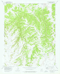
1972 Map of Klagetoh South
USGS Topo · Published 1976About this map
Navajo Indian Reservation lands in Apache County are captured here in the early 1970s, focused on the community of Klagetoh. This area of the high desert shows a sparse settlement pattern dictated by water sources and geography. The Chapter House stands as a central point for the local community, while the presence of the Billy Lynch Well and various unnamed wells and a Spring highlight the critical nature of water access in this arid landscape. The drainage of Wide Ruin Wash cuts through the eastern portion of the quadrangle, serving as a primary geographic landmark. A network of primitive roads and a Jeep Trail provide the only access across the dissected plateaus, illustrating the remote and traditional character of the region before significant modern development reached this part of the reservation.
Find a feature on this map
8 named features on this map. Tap any name to fly to it.
Don’t see what you’re looking for? This feature index may not catch every label — zoom into the map to look around manually.
Map Details
Editions of this 1972 Klagetoh South Map
This is the sole edition of this map. No revisions or reprints were ever made.
Other maps of this area

1886 · Fort Defiance
USGS Topo · 1:250,000

1892 · Fort Defiance
USGS Topo · 1:250,000

1954 · Gallup
USGS Topo · 1:250,000

1958 · Gallup
USGS Topo · 1:250,000

1959 · Gallup
USGS Topo · 1:250,000

1962 · Gallup
USGS Topo · 1:250,000

1967 · Gallup
USGS Topo · 1:250,000

1971 · Wide Ruins
USGS Topo · 1:24,000
1971 · Tudecoz Spring
USGS Topo · 1:24,000
1971 · Wide Ruins SW
USGS Topo · 1:24,000