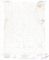
1970 Map of Klondike
USGS Topo · Published 1982About this map
Tonopah-Hasbrouck Mine sits prominently near Hasbrouck Peak in this high-desert landscape of Esmeralda County, Nevada. The mapping highlights a transition from early industrial activity to the environmental challenges of the Great Basin, evidenced by the presence of a Klondike Well (Dry) and the Alkali Lake Alkali Flat. The former transportation network is preserved through the Old Railroad Grade and various Jeep Trails that traverse the arid terrain. Near the southern edge, the Klondike (Site) marks the location of a previous settlement, situated near the Base Line and the extensive drainage of Big Wash. This survey reflects the persistence of mining and infrastructure in a region defined by its scarce water resources and strategic rail history.
Find a feature on this map
14 named features on this map. Tap any name to fly to it.
Don’t see what you’re looking for? This feature index may not catch every label — zoom into the map to look around manually.
Map Details
Editions of this 1970 Klondike Map
2 editions found
Other maps of this area

1907 · Tonopah
USGS Topo · 1:250,000

1908 · Lida
USGS Topo · 1:250,000

1908 · Tonopah
USGS Topo · 1:250,000

1913 · Lida
USGS Topo · 1:250,000

1945 · Goldfield
USGS Topo · 1:125,000

1952 · Mud Lake
USGS Topo · 1:62,500

1954 · Goldfield
USGS Topo · 1:250,000

1955 · Goldfield
USGS Topo · 1:250,000

1956 · Tonopah
USGS Topo · 1:250,000

1958 · Goldfield
USGS Topo · 1:250,000