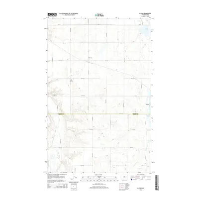
2014 Map of Kloten
USGS Topo · Published 2014About this map
Kloten and the western edge of Aneta define the settled landscape of this prairie region where the borders of Nelson Co and Griggs Co meet. The geography is characterized by the winding path of the Sheyenne River in the southwest and a series of glacial water bodies to the north and east, including Hillesland Lake, Omild Slough, and Pickerel Lake. These features, along with Pickerel Lake Cr, dictate the drainage patterns across a grid of section-line roads like Co Road 3236 and ND-15. For local historians, the placement of Valley Grove Cem provides a specific point of reference for early community roots. The map illustrates a classic North Dakota township structure, where small rural hubs are linked by an extensive network of named avenues and streets such as 117th Ave NE.
Find a feature on this map
28 named features on this map. Tap any name to fly to it.
Don’t see what you’re looking for? This feature index may not catch every label — zoom into the map to look around manually.
Map Details
Editions of this 2014 Kloten Map
This is the sole edition of this map. No revisions or reprints were ever made.
Other maps of this area

1939 · Niagara
USGS Topo · 1:62,500

1942 · McVille
USGS Topo · 1:62,500

1952 · Grand Forks
USGS Topo · 1:250,000

1952 · New Rockford
USGS Topo · 1:250,000

1956 · New Rockford
USGS Topo · 1:250,000

1956 · Grand Forks
USGS Topo · 1:250,000

1961 · Kloten NW
USGS Topo · 1:24,000

1961 · Jessie
USGS Topo · 1:24,000
1961 · McVille
USGS Topo · 1:24,000

1963 · Niagara SW
USGS Topo · 1:24,000