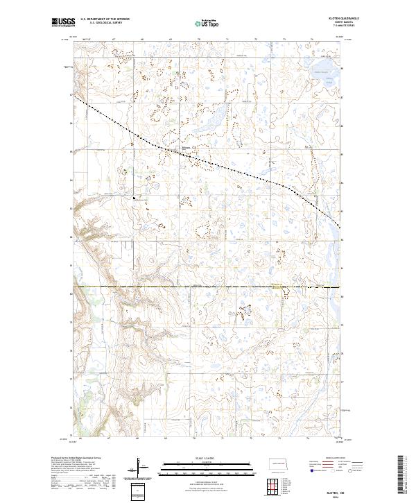
2024 Map of Kloten
USGS Topo · Published 2024About this map
Kloten serves as the central point of reference in this Nelson County landscape, where the prairie is defined by a complex network of glacial wetlands and watercourses. To the north, Omild Slough and Solberg Slough illustrate the characteristic pothole geology of the region, while the Sheyenne River meanders through the western reaches of the survey. The mapping reveals a distinct emphasis on conservation, with the Nelson County Waterfowl Production Area and the Griggs County Waterfowl Production Area straddling the county line. For those researching local heritage, the Valley Grove Cem is clearly marked south of the townsite, providing a specific point for genealogical study. The landscape is organized by a precise grid of rural routes, including Co Rd 20 and several numbered streets that facilitate access across this agricultural and protected waterfowl habitat.
Find a feature on this map
22 named features on this map. Tap any name to fly to it.
Don’t see what you’re looking for? This feature index may not catch every label — zoom into the map to look around manually.
Map Details
Editions of this 2024 Kloten Map
This is the sole edition of this map. No revisions or reprints were ever made.
Other maps of this area

1939 · Niagara
USGS Topo · 1:62,500

1942 · McVille
USGS Topo · 1:62,500

1952 · Grand Forks
USGS Topo · 1:250,000

1952 · New Rockford
USGS Topo · 1:250,000

1956 · New Rockford
USGS Topo · 1:250,000

1956 · Grand Forks
USGS Topo · 1:250,000

1961 · Kloten NW
USGS Topo · 1:24,000

1961 · Jessie
USGS Topo · 1:24,000
1961 · McVille
USGS Topo · 1:24,000

1963 · Niagara SW
USGS Topo · 1:24,000