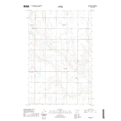
2020 Map of Kloten SE
USGS Topo · Published 2020About this map
Sheyenne River meanders across this rural landscape in Griggs County, carving a distinct valley through the prairie. The map documents a classic North Dakota township structure, defined by a grid of local roads such as 7th St NE and 14th St NE that connect isolated farmsteads and cultural landmarks. For genealogists and local historians, the sheet identifies significant community focal points, including the Ottawa Lutheran Church and its associated Ottawa Lutheran Church Cem in the northwest, as well as the Ringsaker Lutheran Cem situated further south. These sites, along with the drainage of Pickerel Lake Cr, highlight the enduring patterns of settlement and faith in the region's agricultural heartland.
Find a feature on this map
19 named features on this map. Tap any name to fly to it.
Don’t see what you’re looking for? This feature index may not catch every label — zoom into the map to look around manually.
Map Details
Editions of this 2020 Kloten SE Map
This is the sole edition of this map. No revisions or reprints were ever made.
Other maps of this area

1952 · Grand Forks
USGS Topo · 1:250,000

1952 · New Rockford
USGS Topo · 1:250,000

1956 · New Rockford
USGS Topo · 1:250,000

1956 · Grand Forks
USGS Topo · 1:250,000

1961 · Kloten NW
USGS Topo · 1:24,000

1961 · Cooperstown East
USGS Topo · 1:24,000

1961 · Jessie
USGS Topo · 1:24,000

1961 · Cooperstown West
USGS Topo · 1:24,000

1966 · Grand Forks
USGS Topo · 1:250,000
1967 · Kloten SE
USGS Topo · 1:24,000