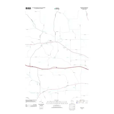
2013 Map of Knapp
USGS Topo · Published 2013About this map
Knapp serves as the primary hub of activity in this area of Dunn County, situated along the corridor of Us-12 and Main St. The landscape is defined by a dense network of waterways that carve through the terrain, including Wilson Cr and its northern branch, N Br Wilson Cr, which wind past the village center. Further south, the course of Rush Cr and Hay Cr run parallel to the modern interstate, while the southern reaches are drained by the multiple forks of Gilbert Cr. Local history is anchored by markers such as Cemetery Rd, which branches off the highway east of the main settlement. The map reflects a rural infrastructure built around a grid of numbered avenues and streets, including 890th Ave and 210th St, showing how modern transportation routes have been overlaid upon the traditional valley-and-creek geography of western Wisconsin.
Find a feature on this map
59 named features on this map. Tap any name to fly to it.
Don’t see what you’re looking for? This feature index may not catch every label — zoom into the map to look around manually.
Map Details
Editions of this 2013 Knapp Map
This is the sole edition of this map. No revisions or reprints were ever made.
Other maps of this area

1940 · Menomonie
USGS Topo · 1:62,500

1942 · Menomonie
USGS Topo · 1:62,500

1946 · Knapp
USGS Topo · 1:62,500

1948 · Downing
USGS Topo · 1:62,500

1949 · Knapp
USGS Topo · 1:62,500

1949 · Ridgeland
USGS Topo · 1:62,500

1950 · Downing
USGS Topo · 1:62,500

1951 · Ridgeland
USGS Topo · 1:62,500

1953 · Saint Paul
USGS Topo · 1:250,000

1953 · Eau Claire
USGS Topo · 1:250,000