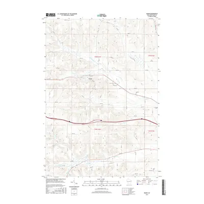
2015 Map of Knapp
USGS Topo · Published 2015About this map
The village of Knapp serves as the central hub of this western Dunn County landscape, situated where the terrain transitions into a complex network of ridges and narrow valleys. This area is defined by its water drainage patterns, with Wilson Cr and its northern branch cutting through the northern half, while Gilbert Cr and the Middle Br Gilbert Cr dominate the south. These creek systems dictated the early placement of roads and farmsteads, many of which are marked by family and community burial grounds including Forest Hill Cem, Teegarden Cem, and Mamre Cem. The map reveals a highly structured grid of section lines and rural avenues, such as 890th Ave and 530th Ave, which slice through the natural topography. This creates a striking visual contrast between the rigid geometric survey lines and the organic, winding paths of Hay Cr and Rush Cr.
Find a feature on this map
48 named features on this map. Tap any name to fly to it.
Don’t see what you’re looking for? This feature index may not catch every label — zoom into the map to look around manually.
Map Details
Editions of this 2015 Knapp Map
This is the sole edition of this map. No revisions or reprints were ever made.
Other maps of this area

1940 · Menomonie
USGS Topo · 1:62,500

1942 · Menomonie
USGS Topo · 1:62,500

1946 · Knapp
USGS Topo · 1:62,500

1948 · Downing
USGS Topo · 1:62,500

1949 · Knapp
USGS Topo · 1:62,500

1949 · Ridgeland
USGS Topo · 1:62,500

1950 · Downing
USGS Topo · 1:62,500

1951 · Ridgeland
USGS Topo · 1:62,500

1953 · Saint Paul
USGS Topo · 1:250,000

1953 · Eau Claire
USGS Topo · 1:250,000