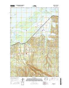
2017 Map of Knappa
USGS Topo · Published 2017About this map
The Columbia River dominates the northern reaches of this coastal landscape, where a complex network of channels and marshlands defines the river's approach to the Pacific. Low-lying landforms like Karlson Island, Marsh Island, and Horseshoe Island are separated by intricate waterways including Blind Slough and Prairie Channel. The settlement of Brownsmead sits amidst this alluvial terrain, connected by a web of local roads such as Penttila Rd and Fertile Valley Rd. To the south, the topography rises sharply toward Wickiup Ridge, showing the transition from riverine flats to timbered uplands.
Find a feature on this map
81 named features on this map. Tap any name to fly to it.
Don’t see what you’re looking for? This feature index may not catch every label — zoom into the map to look around manually.
Map Details
Editions of this 2017 Knappa Map
This is the sole edition of this map. No revisions or reprints were ever made.
Other maps of this area

1940 · Svensen
USGS Topo · 1:62,500

1940 · Brookfield
USGS Topo · 1:62,500

1941 · Skamokawa
USGS Topo · 1:62,500

1941 · Cathlamet
USGS Topo · 1:62,500

1949 · Cathlamet Bay
USGS Topo · 1:24,000

1949 · Green Mountain
USGS Topo · 1:24,000

1949 · Rosburg
USGS Topo · 1:24,000

1953 · Hoquiam
USGS Topo · 1:250,000

1953 · Skamokawa
USGS Topo · 1:62,500

1953 · Cathlamet
USGS Topo · 1:62,500