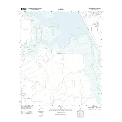
2012 Map of Knickerbocker
USGS Topo · Published 2012About this map
Twin Buttes Reservoir and the Middle Concho River dominate this West Texas landscape southwest of San Angelo in the early 21st century. The map centers on the massive water storage and irrigation infrastructure that supports the region, including Lake Nasworthy and smaller impoundments like Ripple Reservoir and Fey Reservoir. Along the southern edge of the primary reservoir, the historic crossing known as Negro Crossing and the settlement of Knickerbocker anchor the local geography.
Find a feature on this map
44 named features on this map. Tap any name to fly to it.
Don’t see what you’re looking for? This feature index may not catch every label — zoom into the map to look around manually.
Map Details
Editions of this 2012 Knickerbocker Map
This is the sole edition of this map. No revisions or reprints were ever made.
Other maps of this area

1892 · San Angelo
USGS Topo · 1:125,000

1895 · Sherwood
USGS Topo · 1:125,000

1924 · San Angelo 2-c
USGS Topo · 1:48,000

1924 · Sherwood 1-d
USGS Topo · 1:48,000

1924 · San Angelo 2-b
USGS Topo · 1:48,000

1924 · Sherwood 1-a
USGS Topo · 1:48,000

1928 · Wall
USGS Topo · 1:62,500

1928 · Tankersly
USGS Topo · 1:62,500

1954 · San Angelo
USGS Topo · 1:250,000

1957 · Twin Buttes
USGS Topo · 1:24,000