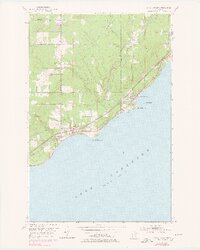
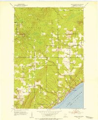
1953 Map of Knife River
USGS Topo · Published 1978About this map
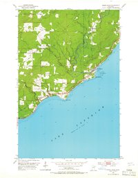
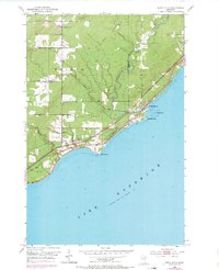
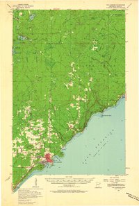
The rocky North Shore of Lake Superior dominates this mid-century survey, where the Knife River meets the lake at the eponymous settlement of Knife River. This coastal corridor is defined by its transportation history, showing the Duluth Missabe and Iron Range railroad running parallel to Shore Drive. In the uplands, an Old Railroad Grade traces the path of earlier timber or industrial extraction through the township of Duluth, crossing the St. Louis and Lake County line. Local life is centered around landmarks like the Community Ch and the Town Hall, while genealogy interests are served by the Lake View Cem positioned near the shoreline. The map captures a transition as the area developed between the established villages of Palmers and Little and the natural features of Stony Point and Granite Point.
Find a feature on this map
21 named features on this map. Tap any name to fly to it.
Don’t see what you’re looking for? This feature index may not catch every label — zoom into the map to look around manually.
Map Details
Editions of this 1953 Knife River Map
4 editions found
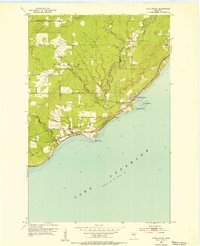
Other maps of this area
1953 · Lakewood
USGS Topo · 1:24,000
1953 · French River
USGS Topo · 1:24,000
1953 · Knife River
USGS Topo · 1:24,000

1953 · Ashland
USGS Topo · 1:250,000
1954 · Barrs Lake
USGS Topo · 1:24,000
1954 · Mc Carthy Creek
USGS Topo · 1:24,000

1954 · Two Harbors
USGS Topo · 1:250,000

1957 · Two Harbors
USGS Topo · 1:250,000
1957 · Two Harbors
USGS Topo · 1:62,500

1957 · Two Harbors
USGS Topo · 1:24,000
Featured Places
- Duluth Township, MN
- Lake No. 2, MN
- Knife River, Lake No. 2
- Palmers, Duluth Township
- Saint Louis County, MN