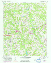
1967 Map of Knightdale
USGS Topo · Published 1992About this map
Knightdale and Wendell anchor this eastern Wake County landscape during a period of transition in the late 1960s. The area is defined by a network of crossroads settlements and family-named landmarks, including Six Forks Crossroads, Lizard Lick, and Eagle Rock. These communities are connected by the Norfolk Southern railroad, which runs parallel to the growing highway infrastructure that would eventually shape the region's suburban development.
Find a feature on this map
34 named features on this map. Tap any name to fly to it.
Don’t see what you’re looking for? This feature index may not catch every label — zoom into the map to look around manually.
Map Details
Editions of this 1967 Knightdale Map
4 editions found
Other maps of this area

1943 · Raleigh
USGS Topo · 1:62,500

1951 · Raleigh
USGS Topo · 1:62,500

1953 · Raleigh
USGS Topo · 1:250,000

1954 · Raleigh
USGS Topo · 1:250,000

1964 · Garner
USGS Topo · 1:24,000

1964 · Flowers
USGS Topo · 1:24,000

1964 · Selma
USGS Topo · 1:62,500

1964 · Clayton
USGS Topo · 1:24,000

1964 · Garner
USGS Topo · 1:62,500

1967 · Knightdale
USGS Topo · 1:24,000