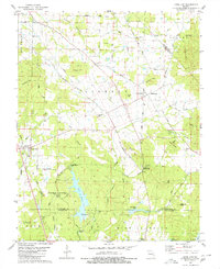
1980 Map of Knob Lick
USGS Topo · Published 1980About this map
Knob Lick and Libertyville anchor this 1980 survey of the rural landscape where the St Francois, Ste Genevieve, and Madison county lines meet. The terrain is defined by prominent elevations like Gibson Hill, Bain Hill, and the volcanic protrusion of Castle Rock, while water from the Little St Francis River and Nims Lake drains the valleys. The map documents a scattered community structure, with social life centered on locations such as Wesley Chapel, Crossroads Ch, and the S-F Scout Ranch.
Find a feature on this map
52 named features on this map. Tap any name to fly to it.
Don’t see what you’re looking for? This feature index may not catch every label — zoom into the map to look around manually.
Map Details
Editions of this 1980 Knob Lick Map
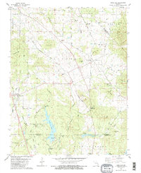
2 editions found
Other maps of this area

1904 · Farmington
USGS Topo · 1:62,500

1906 · Farmington
USGS Topo · 1:62,500

1907 · Weingarten
USGS Topo · 1:62,500

1909 · Weingarten
USGS Topo · 1:62,500

1910 · Higdon
USGS Topo · 1:62,500

1939 · Fredericktown
USGS Topo · 1:48,000

1947 · Fredericktown
USGS Topo · 1:62,500

1949 · Rolla
USGS Topo · 1:250,000

1950 · Fredericktown
USGS Topo · 1:62,500

1953 · Rolla
USGS Topo · 1:250,000