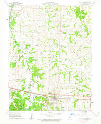
1962 Map of Knob Noster
USGS Topo · Published 1963About this map
The Missouri Pacific railroad corridor serves as a primary east-west artery across this central Missouri landscape, anchoring the development of Knob Noster and the nearby Whiteman Air Force Base. To the north, the terrain is defined by the winding course of the Blackwater River and its many tributaries, including Walnut Creek and Clear Fork. The map reveals a deeply established rural social fabric, evidenced by numerous country churches such as Immanuel Ch and Dunkard Ch, alongside family-named cemeteries like Rothwell Cem and Hocker Cem.
Find a feature on this map
39 named features on this map. Tap any name to fly to it.
Don’t see what you’re looking for? This feature index may not catch every label — zoom into the map to look around manually.
Map Details
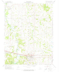
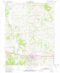
Editions of this 1962 Knob Noster Map
3 editions found
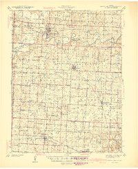
Other maps of this area

1885 · Warrensburg
USGS Topo · 1:125,000

1887 · Sedalia
USGS Topo · 1:125,000

1887 · Warrensburg
USGS Topo · 1:125,000

1894 · Sedalia
USGS Topo · 1:125,000

1894 · Warrensburg
USGS Topo · 1:125,000

1917 · Knobnoster
USGS Topo · 1:62,500

1939 · Sweet Springs
USGS Topo · 1:62,500

1940 · Sweet Springs
USGS Topo · 1:62,500
1941 · Sweet Springs
USGS Topo · 1:62,500

1945 · Sweet Springs
USGS Topo · 1:62,500