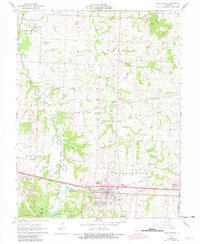
1962 Map of Knob Noster
USGS Topo · Published 1982About this map
Knob Noster State Park anchors the southern portion of this Missouri landscape, where the Clear Fork river winds through a terrain marked by small lakes like Sullivan Lake and Redbud Lake. The town of Knob Noster serves as a central hub, situated along the Missouri Pacific railroad line and just north of the expanding footprint of Whiteman Air Force Base. The transition from rural farmland to military and recreational use is evident, with traditional sites like Dunkard Ch and Immanuel Ch standing alongside industrial features including a Strip Mine and a Quarry. Genealogists will find a wealth of burial grounds scattered across the townships of Simpson, Grover, and Montserrat, ranging from the Wampler Cem to the Hocker Cem. These small cemeteries and named peaks like Cooks Knob provide a sense of the area's established family history before the mid-century developments.
Find a feature on this map
43 named features on this map. Tap any name to fly to it.
Don’t see what you’re looking for? This feature index may not catch every label — zoom into the map to look around manually.
Map Details
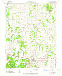
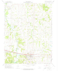
Editions of this 1962 Knob Noster Map
3 editions found
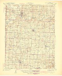
Other maps of this area

1885 · Warrensburg
USGS Topo · 1:125,000

1887 · Sedalia
USGS Topo · 1:125,000

1887 · Warrensburg
USGS Topo · 1:125,000

1894 · Sedalia
USGS Topo · 1:125,000

1894 · Warrensburg
USGS Topo · 1:125,000

1917 · Knobnoster
USGS Topo · 1:62,500

1939 · Sweet Springs
USGS Topo · 1:62,500

1940 · Sweet Springs
USGS Topo · 1:62,500
1941 · Sweet Springs
USGS Topo · 1:62,500

1945 · Sweet Springs
USGS Topo · 1:62,500